June 24 – July 3, 2006
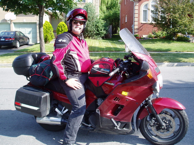
2003 Kawasaki Concours
David Grenier
Introduction |
|||
| The initial plan, months ago, was to attend the Concours Owners Group (COG) national rally, this year being held in Hill City, South Dakota, from June 26-30. Prior to that I had wanted to do the Highway 11 (Yonge St.) ride between Toronto and Rainy River, but work pressures prevented me from doing that one. And there was the desire to finally be able to successfully complete the Bun Burner Gold ride: 1500 miles in 24 hours. I had attempted the ride twice before, once in 2004 and again in 2005, but failed both times.Normally by this time in the season I would have had at least a few weekends of good, long rides under my belt, but work and family commitments had limited me to a single ride around Perth, about 800 km, a month earlier, and several much shorter rides. Needless to say, the thought of such a trip, and the possible problems, bothered me.Undaunted, and badly needing a break from work, I decided to attempt the Bun Burner Gold ride from Toronto as the first leg of the trip. Mapping the route so I could get the distance in the allotted time proved challenging so I opted to go from Toronto to Denver, CO, then double-back to Lincoln, NE, for the COG rally. I figured if I didn’t think I could make it I could bail out at Lincoln.After the rally finished, I’d head back home via Rainy River for the ride to 1 Yonge St., capping a trip covering a distance I had never before attempted. Previously my longest trip was about 6,500 km.
Click on an image to see it full size. |
|||
Bun Burner Gold – Toronto to Denver |
|||
 Saturday, June 24 I left at 9:30am after having Brenda and a neightbour fill out the Start Witness form. The odometerI went up to the 407 ETR, to 401, 402 to the Sarnia crossing. I’m glad I made some good time on the highways because I was stuck in a lineup at the border for almost 45 minutes before I could get into the USA. Out of 24 hours, that’s a huge chunk of time.In Michigan I ran into some construction zones but nothing that was too bad. Just before hitting Indiana I was moving along “with the traffic” and passed a couple of motorcycles, not realizing one was a local sheriff. He caught up to me and jabbed at his speedometer, telling me to slow down. Whew, that was close.The ride through Indiana and the first part of Illinois wasn’t a problem, until I got near the Chicago area. Construction around a tollbooth knocked another 30 minutes off my time, all to get $0.60. At this point I was starting to seriously question whether the delays had set me back too far. Saturday, June 24 I left at 9:30am after having Brenda and a neightbour fill out the Start Witness form. The odometerI went up to the 407 ETR, to 401, 402 to the Sarnia crossing. I’m glad I made some good time on the highways because I was stuck in a lineup at the border for almost 45 minutes before I could get into the USA. Out of 24 hours, that’s a huge chunk of time.In Michigan I ran into some construction zones but nothing that was too bad. Just before hitting Indiana I was moving along “with the traffic” and passed a couple of motorcycles, not realizing one was a local sheriff. He caught up to me and jabbed at his speedometer, telling me to slow down. Whew, that was close.The ride through Indiana and the first part of Illinois wasn’t a problem, until I got near the Chicago area. Construction around a tollbooth knocked another 30 minutes off my time, all to get $0.60. At this point I was starting to seriously question whether the delays had set me back too far.
Trusting I could make up the time, I pressed on. Once past the Chicago area there was clear sailing. I quickly got through the rest of Illinois and entered Iowa. During the late evening around Des Moines, I started seeing twinkling in the grass and bushes on the side of the road. Fireflies! Millions of them! A couple splattered on my windscreen and kept their lights for 20-30 seconds before dying. After the fascination wore off, I realized trying to spot animal eyeballs at night in a sea of fireflies would be next to impossible. That got my attention back on the road, really fast. |
|||
Sunday, June 25 I got into Nebraska and passed Lincoln, the starting point for the COG rally, but not until the next day. The trip through Nebraska was long and I started getting tired as I was approaching the western end of the state. By the time I got into Colorado my body was screaming for sleep, but I didn’t want to risk it. I knew if I stopped I’d have a repeat of the Florida attempt and be so tired I’d have to stop again, and simply run out of time.Naturally at this point it started raining, and getting cold. Night, higher elevation, sleep deprivation, a boring section of road. What fun!I needed something, anything, to keep my mind alert. I wound up yelling at myself, trying to get the adrenalin pumping. Surprisingly, it worked, but I made myself hoarse in the process. I rode into Denver and filled up at 6:45am (Mountain Time). While peeling off the rain gear, a cop conveniently showed up and signed my End Form. I also had the counter clerk sign it. The BBG was official! I rode into Denver and filled up at 6:45am (Mountain Time). While peeling off the rain gear, a cop conveniently showed up and signed my End Form. I also had the counter clerk sign it. The BBG was official!
I had ridden for 23 hours, 15 minutes. The odometer claimed 60,500 km (a distance of 2,528 km) while the GPS claimed 2,475 km (1,537 miles). I had crossed into 2 new time zones (Central and Mountain). The perfect solution when 24 hours in a day just isn’t enough! Now all that’s left is the final paperwork and submission to IBA. |
|||
Bun Burner Continuation – Denver to Lincoln |
|||
| With the rain gear and extra layers stowed, I started heading back to Lincoln, NE for the COG rally check-in, but I had to address some more immediate needs. I grabbed a quick bite and found a nice shady spot near a picnic table for a snooze. I set the Screaming Meanie for 90 minutes and quickly fell asleep. Damn, I woke up 30 minutes later and couldn’t get back to sleep. At the vending machine, I grabbed a Mountain Dew (lots of sugar and caffeine) and kept driving towards Nebraska via Kansas. Once I got off the interstate I went on lots of back roads, winding up the middle of the state. I think in my tired state I may have accidentally told the GPS to use the shortest route rather than the fastest. At least I went on some nice roads.Needless to say I was getting a little tired so I reset the GPS to get me to the hotel ASAP. It still took another 3 hours before I arrived in Lincoln and got the final fill up, total 33 hours, 45 minutes, 3,416 km (2,122 miles). I went to the Days Inn where the rest of the COGgers were staying and got my Bun Burner End Form witnessed. This ride may be a bit more difficult to document as the GPS had me going on some weird roads, but I’ll give it a try. | |||
COG National Rally – Lincoln, NE |
|||
| After I checked into the Days Inn, I went to get a real meal, the first one in 2 days. (The last one was Friday evening before I left.) I ordered a steak, but couldn’t finish it! I left about a third of the meal! Trust me. That doesn’t happen very often.I went back to the hotel and crashed around 8pm local time. | |||
| Monday, June 26 I woke up the next morning around 9:30am and grabbed a quick shower. When I went to pack up the bike, I found the tree I decided to park under housed an extended family of birds, apparently all with extremely accurate bowel movements. It took a half hour of scrubbing to get all the crap off. I’ll probably wind up having a towel or two charged to my credit card. | |||
| After moving the bike to a safer location, I went back into the hotel and planned some of the sites I wanted to see while I was in Nebraska.At 12:30 I was at the Kawasaki plant for the scheduled tour. They have a large facility there, with one part for the fabrication and assembly of ATVs, watercraft and Mules (sadly, no more motorcycles). Another plant next door makes light rail (subway) cars. The Kawasaki rep said the plant started in 1975 with motorcycles as their only product. Over the years new products came on line and the percentage of bikes kept dropping until head office decided it didn’t make any sense to continue their manufacture at that location, moving it to Japan. There is an expectation motorcycle fabrication and assembly will return, but there’s no timeline. | |||
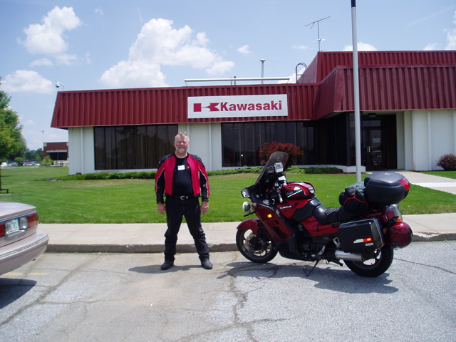 They had a product showroom, displaying examples of their products from each year, ATVs, jet skis and motorcycles: a nice collection. Back on the floor, we saw the last Concours, under plastic. Sniff. It’s official. The “Connie” is no more, though there’s speculation another sport touring bike may be just around the corner. Unfortunately, company policy meant we couldn’t take any pictures of the plant. They had a product showroom, displaying examples of their products from each year, ATVs, jet skis and motorcycles: a nice collection. Back on the floor, we saw the last Concours, under plastic. Sniff. It’s official. The “Connie” is no more, though there’s speculation another sport touring bike may be just around the corner. Unfortunately, company policy meant we couldn’t take any pictures of the plant. |
|||
COG National Rally – Hill City, SD |
|||
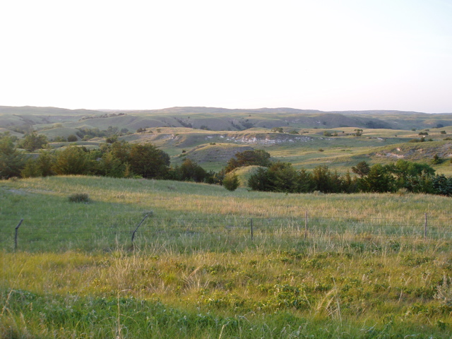
After the tour, the rally continued in Hill City, South Dakota, but I had to get there first. The COG organizers had planned four routes. I picked the Sand Hills route since they claimed the 200+ mile stretch from Grand Island to Alliance was one of the best scenic routes in the country.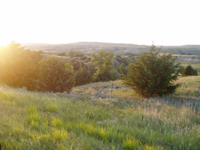 Scenic is one word. Not many straight miles, but in places it resembled a desert. Instead of rolling sand dunes, there were rolling sand dunes with grass on them, as far as the eye can see. Scenic is one word. Not many straight miles, but in places it resembled a desert. Instead of rolling sand dunes, there were rolling sand dunes with grass on them, as far as the eye can see.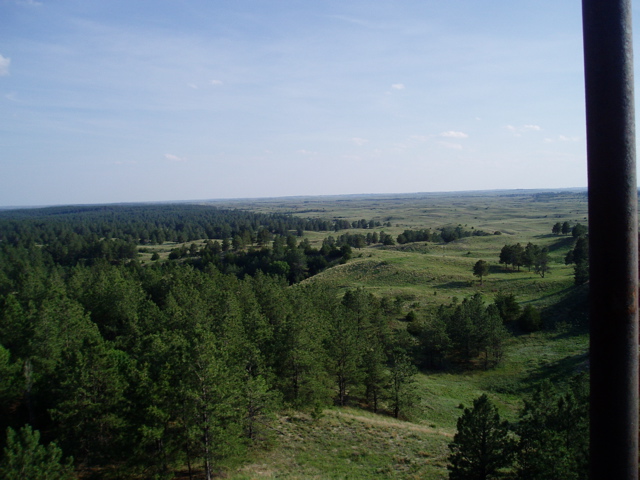 At Halsey National Forest, a man-made forest in the middle of this “desert” there’s an observation tower where you can see the demarcation between the rolling sand hills and the forest – it’s quite dramatic.I had met up with a fellow COGger (Jeff from outside Seattle) just before and we decided to head to Alliance together. Checking my gas gauge I felt it would be a good idea to fill up. I punched up the nearest gas on the GPS – 200+ km to the west (the direction we needed to go), or 70km back east. Ouch. We started heading back east and found an unmanned self-serve about 50km later. At least we didn’t have to go all the way to Broken Bow. At Halsey National Forest, a man-made forest in the middle of this “desert” there’s an observation tower where you can see the demarcation between the rolling sand hills and the forest – it’s quite dramatic.I had met up with a fellow COGger (Jeff from outside Seattle) just before and we decided to head to Alliance together. Checking my gas gauge I felt it would be a good idea to fill up. I punched up the nearest gas on the GPS – 200+ km to the west (the direction we needed to go), or 70km back east. Ouch. We started heading back east and found an unmanned self-serve about 50km later. At least we didn’t have to go all the way to Broken Bow.
With our tanks filled, we turned west towards Alliance. As luck would have it, about 40km past Halsey, there were two gas stations, neither of which existed as far as the GPS was concerned. I guess the Nebraska map hadn’t been updated in a while. As we drove along this rather long stretch of road, the sand hills became more dramatic, but so did the desolation. There were easily 50 miles of road where there was absolutely no large life forms – humans, cattle, horses, nothing. And there wasn’t a whole lot of traffic either. If you got stuck, you’d be waiting a very long time for help, or walking a very long way. The last 30 minutes towards Alliance was quite dark so I put on the extra lights. That really helped. Once we got there, Jeff met up with his camping buddies while I went to the hotel. As I was riding in, I noticed my low beam headlight was out. Great! I left my spare in the garage at home. After I checked in and grabbed a quick bite at the local McDonalds (not much else was open at that time) I called ROK Club (Riders of Kawasaki) and got the contact info for 2 dealers, one south in Scottsbluff, another north in Chadron. Since I wanted to see some of the rock formations further south I decided to go that way the next morning. |
|||
Tuesday, June 27 While packing the bike I met up with a couple of COGgers from St. Louis, Betsy and Kevin. Kevin was riding his bike that had been in parts for the last 2 years. He had just put things back together a week before the rally. Betsy was following in their van – just in case. 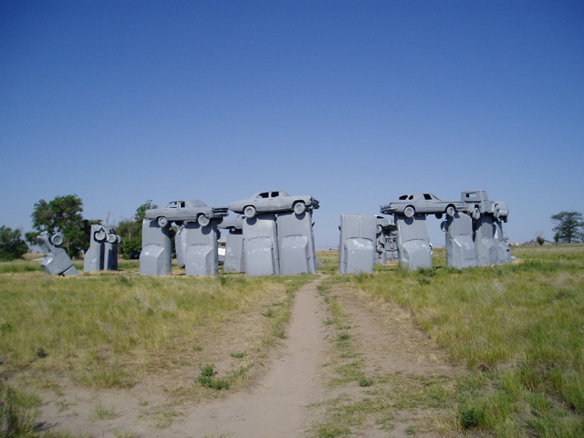 After breakfast at McDonalds (yuck, two meals in a row), we went to Carhenge, a replica of Stonehenge but made out of cars from the 50s and 60s. After that we split up as they were heading north to Hill City and I wanted to go south. After breakfast at McDonalds (yuck, two meals in a row), we went to Carhenge, a replica of Stonehenge but made out of cars from the 50s and 60s. After that we split up as they were heading north to Hill City and I wanted to go south. |
|||
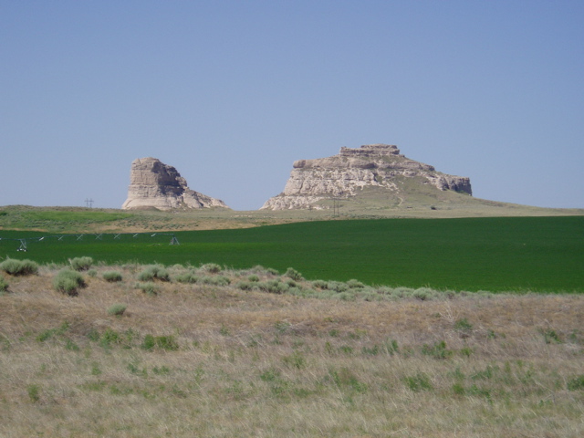  For me, the next stop was the Courthouse and Jail rock formations south of Bridgeport. There was a gravel/sand road leading right up to them where you could hike (I didn’t, though other people were). I wasn’t looking forward to the sand, but thankfully there was a fair bit of gravel on the road so the Connie only shifted a few times. |
|||
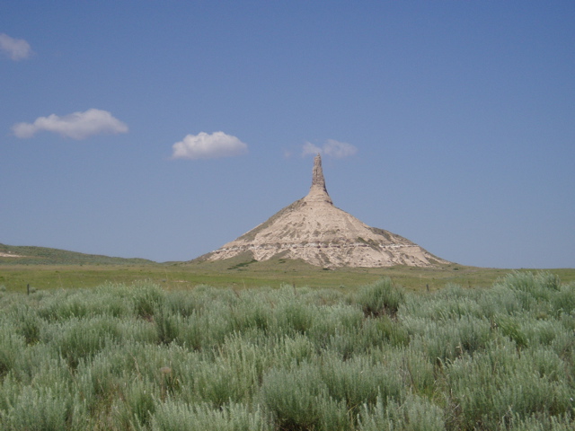 Next was Chimney Rock near Bayard. This one had a visitor centre but there wasn’t an easy way to get closer to the formation. Next was Chimney Rock near Bayard. This one had a visitor centre but there wasn’t an easy way to get closer to the formation. |
|||
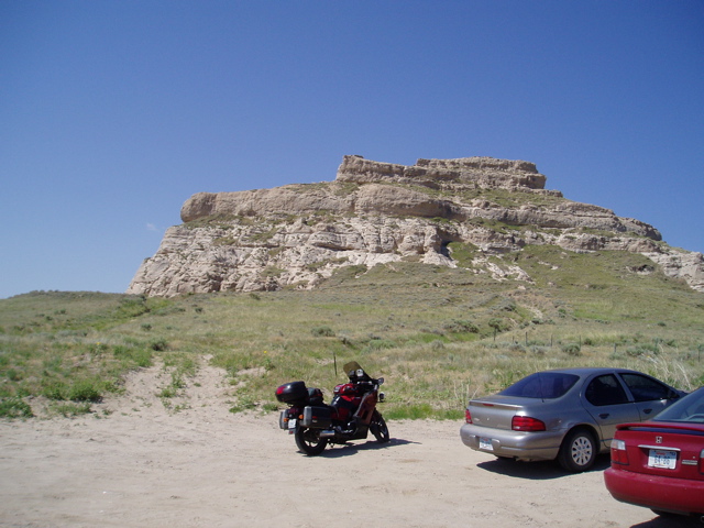
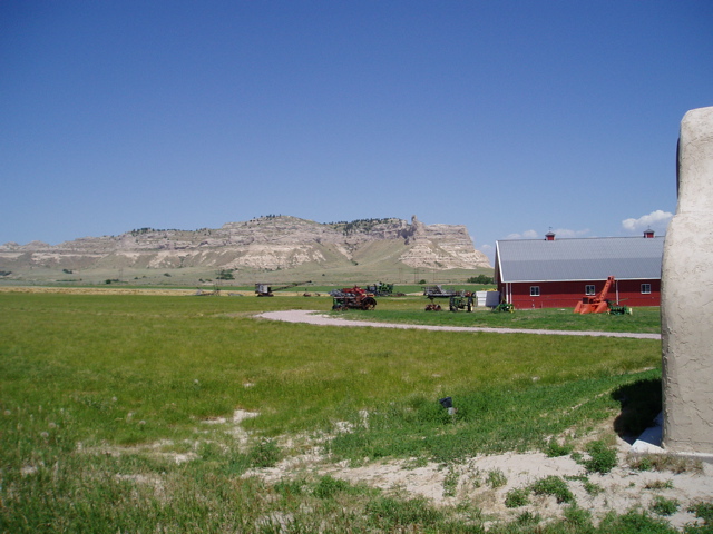 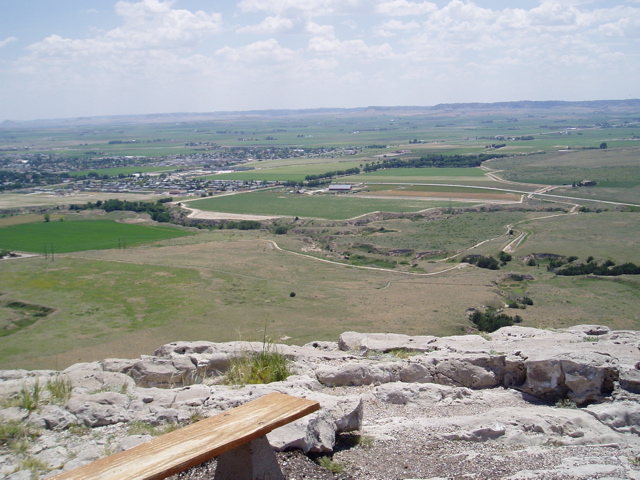 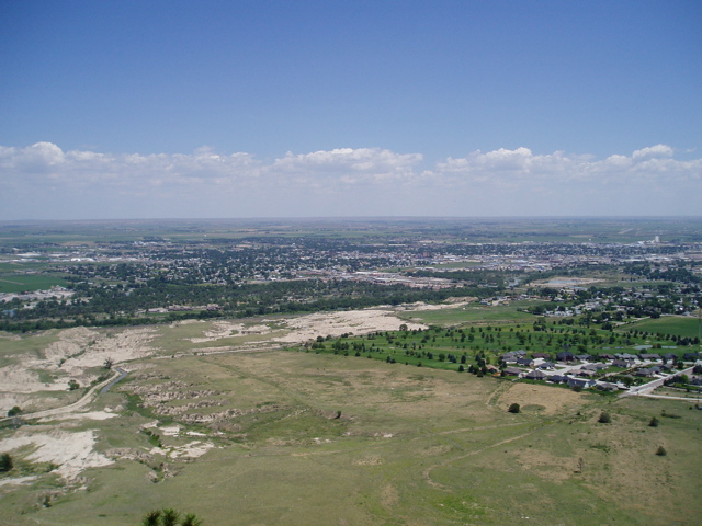 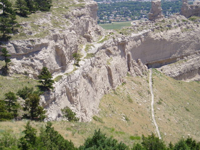 Finally I went to Scotts Bluff. It was named after an employee that was abandoned by his colleagues and left to die near the area. I hiked around the summit and got some photos of the surrounding area, which had been used for the Oregon and Mormon Trails and the Pony Express. For the more adventurous, there’s a hiking trail from the summit all the way down to the visitor centre, but I didn’t think my riding boots and long pants were the best hiking gear, especially since the temperature was 90+. |
|||
Now that my sightseeing was essentially done for the area, I felt it was time to get the bike looked after. I drove the 3 minutes to the dealership to have the headlight bulb replaced and a quick oil and filter change. I figured I’d be out of there in 30 minutes, tops, since they got to work on the bike right away.An hour later, nothing. I’m chatting with the owner of the place about his other venture, a local racecar track. Another 30 minutes go by, then I find out the mechanic can’t get the new bulb in – he’d never done one on a Concours before. I told him what I did, and 30 minutes later it was finally done. Thankfully they only charged me for 30 minutes labour.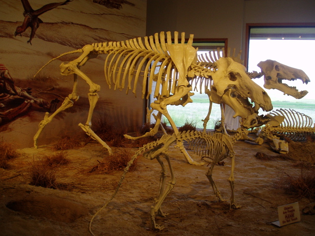 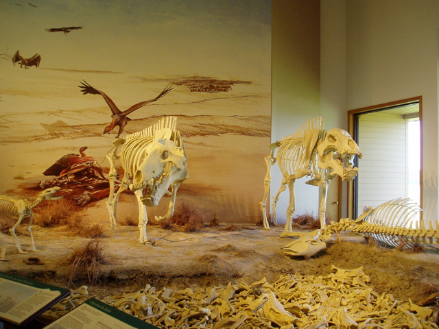 Now I’m back on the road, heading north towards Hill City. I decide to stop off at Agate Fossil Beds on the way, but getting there meant a long ride through more deserted areas of the state. I got there and found out the only way to actually see the beds was to take a 2-mile hike. Ugh! I opt for the movie and recreations of the beds in the visitor centre. Now I’m back on the road, heading north towards Hill City. I decide to stop off at Agate Fossil Beds on the way, but getting there meant a long ride through more deserted areas of the state. I got there and found out the only way to actually see the beds was to take a 2-mile hike. Ugh! I opt for the movie and recreations of the beds in the visitor centre. |
|||
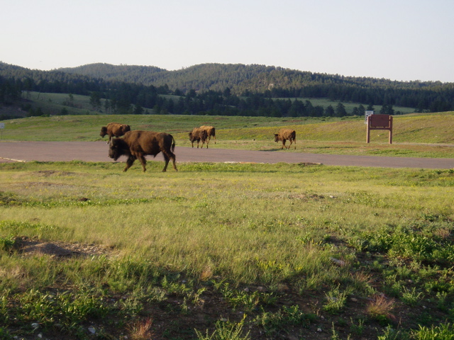
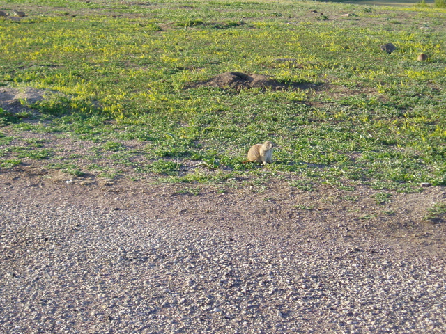
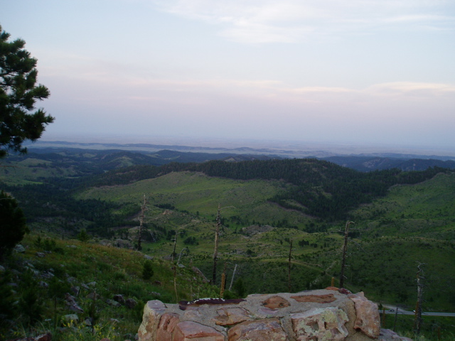
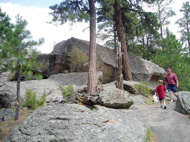
An hour later I’m back on the road, heading north. Another formation I wanted to see was Toadstool. I get to the turnoff and find I have 10+ miles of loose, rutted gravel to ride on to get there. What the hell, I take the plunge and start in. I get about a mile in and the fillings in my teeth are getting jarred loose from the washboard surface. That’s all I need – to get to this place only to have some damage done to the bike, and there was no cell phone coverage which meant a hike back to the highway. Forget it. I turned around and cranked up the speed towards Hill City.Through Custer State Park, just south of Hill City, 2000 pound bison and other animals roam freely. Prairie dogs were standing near their holes, chirping at each other, quite loudly actually.
   |
|||
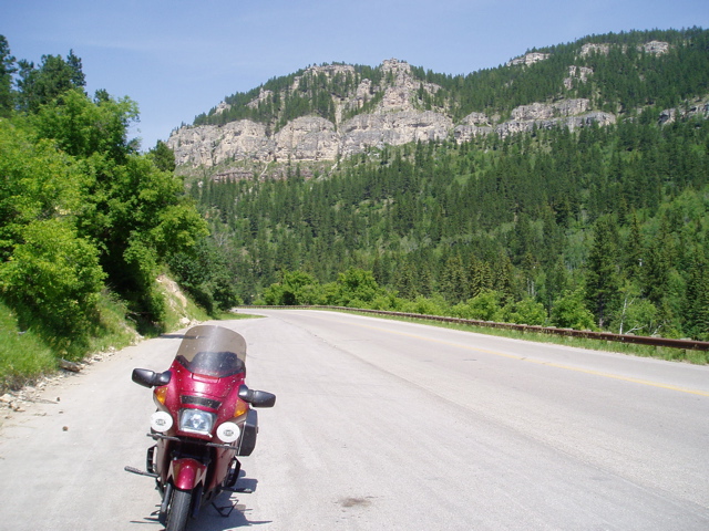
| I got into Hill City around 8:30pm. I missed the registration, but there was supposed to be another one in the morning. I checked in to the Super 8, grabbed a quick bite and hit the sack. | |||
Wednesday, June 28 I woke up at 7:10 and checked the schedule, which I should have done the night before. Oh my God! I’m supposed to be at the Experienced Rider Course offered by MSF, somewhere in Rapid City, a half hour away, starting at 8am. I grabbed a quick shower and went over to the Best Western rally HQ to check-in and found out the details for the course. Registration was supposed to open at 8am, but someone had changed the schedule and it didn’t open until 9am! Four people later I find someone who knew where the ERC was being held and rode off. Right into construction along US 16.45 minutes later I finally rode into the H-D dealership in Rapid City. Their back lot was set up for MSF training and the other 10 COGgers were already there, getting ready for their second exercise. I jumped in and did the course, finishing up around 2pm. Scorching heat, 90+, but it was a great course with lots of slow speed manoeuvres. A few of us went over to a local restaurant for a bite, where I found out one of the riders, BIll, was from Calgary. After lunch we went for a ride on Nemo Road, a local twisty. Not bad. We split up, with Dick (from Oregon) and I continuing up to Deadwood for an ice cream and some more riding. Casinos are the main business in Deadwood, besides feeding off the history of the town (Wild Bill Hickock and Calamity Jane).We went back to Hill City and sat in on part of the COG town hall. The usual griping about web site, missed mailings, etc. We had dinner at the local restaurant and then departed for our respective hotels. A few of us went over to a local restaurant for a bite, where I found out one of the riders, BIll, was from Calgary. After lunch we went for a ride on Nemo Road, a local twisty. Not bad. We split up, with Dick (from Oregon) and I continuing up to Deadwood for an ice cream and some more riding. Casinos are the main business in Deadwood, besides feeding off the history of the town (Wild Bill Hickock and Calamity Jane).We went back to Hill City and sat in on part of the COG town hall. The usual griping about web site, missed mailings, etc. We had dinner at the local restaurant and then departed for our respective hotels. |
|||
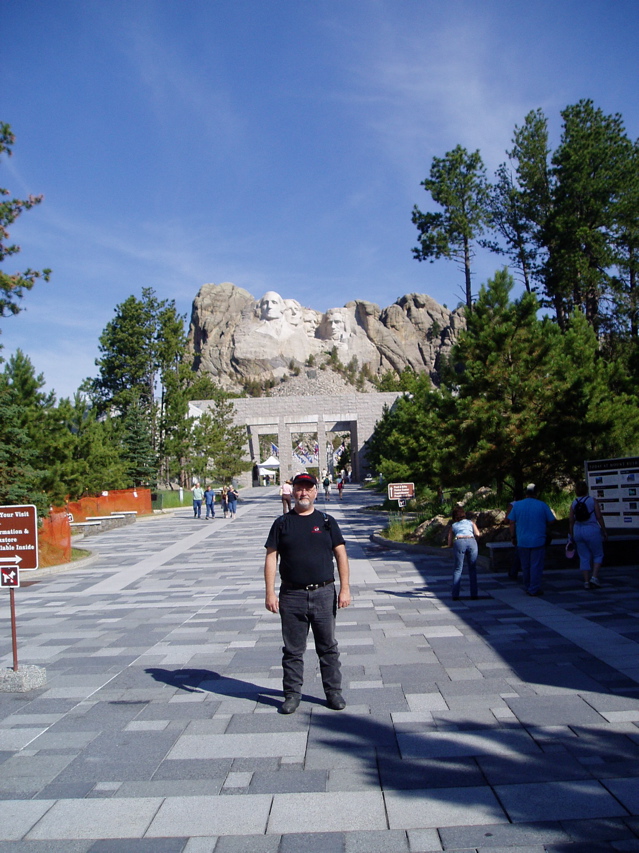
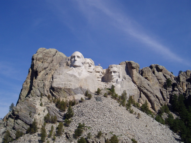
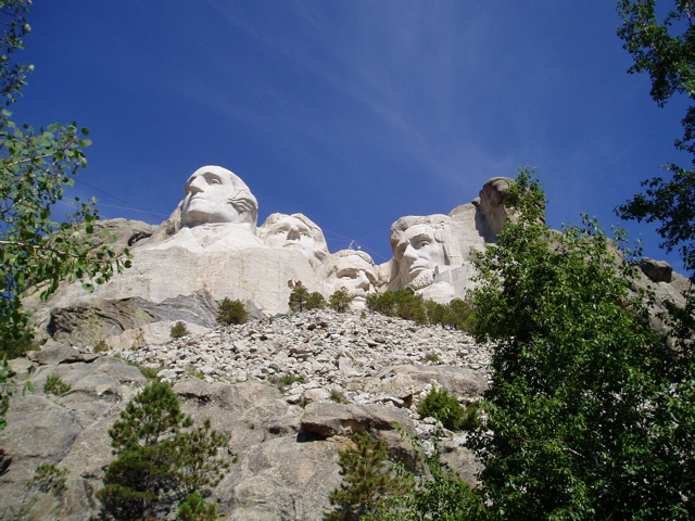
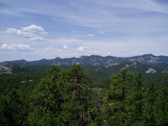
Thursday, June 29 I got up early and went to Mt. Rushmore, a 15-minute ride from the hotel. I wanted to beat the crowds, which were quite small when I got there, but quickly grew by the time I left a couple of hours later. I went on the Presidential Trail to get up closer, but part of it was closed and I could only go about half way. Good thing, too, since it was hot, even at 8:30am. I saw the movie about Mt. Rushmore’s creation (90% “carved” by dynamite) and the sculptor. Bought some souvenirs for the family and went riding some more.
   |
|||
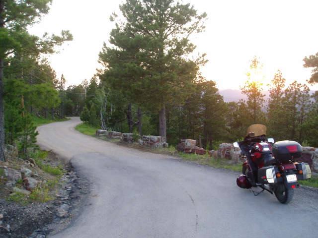
 After the blistering heat, I needed some cooling so I started toward Wind Cave. I went on Iron Mountain Road, a local twisty that actually has some 270° turns, under then over a bridge. Toward the tail end of that road I met up with COGgers from Nebraska (Chris), and Perth, ON (Bill and Rose). Finally, someone else from Ontario! We went on the long tour, about 1.5 hours. We were told to bring a sweatshirt since the cave is at a constant 53°F. I had the sweatshirt on for about 15 minutes. I couldn’t take the heat any more. Sure, it was cool, but there was lots of walking.One of the main features of the cave is “box works”. Cracks in the sandstone were filled with calcite, which hardened. As the sandstone was dissolved by the standing water in the cave, the calcite remained, appeared like boxes used in old postal offices, hence the name.The cave was first discovered by a pair of brothers, but the real adventurer was a 16-year-old boy that mapped several miles of passages over 3 years, all by candlelight, with twine used for finding his way back. Word spread and the cave research expanded. They’ve not mapped over 120 miles of passageways in this 3-dimensional cave, all within a 1 square mile of area, but many hundreds of feet deep. After the blistering heat, I needed some cooling so I started toward Wind Cave. I went on Iron Mountain Road, a local twisty that actually has some 270° turns, under then over a bridge. Toward the tail end of that road I met up with COGgers from Nebraska (Chris), and Perth, ON (Bill and Rose). Finally, someone else from Ontario! We went on the long tour, about 1.5 hours. We were told to bring a sweatshirt since the cave is at a constant 53°F. I had the sweatshirt on for about 15 minutes. I couldn’t take the heat any more. Sure, it was cool, but there was lots of walking.One of the main features of the cave is “box works”. Cracks in the sandstone were filled with calcite, which hardened. As the sandstone was dissolved by the standing water in the cave, the calcite remained, appeared like boxes used in old postal offices, hence the name.The cave was first discovered by a pair of brothers, but the real adventurer was a 16-year-old boy that mapped several miles of passages over 3 years, all by candlelight, with twine used for finding his way back. Word spread and the cave research expanded. They’ve not mapped over 120 miles of passageways in this 3-dimensional cave, all within a 1 square mile of area, but many hundreds of feet deep. |
|||
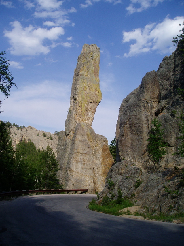 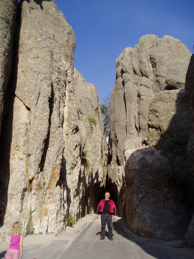 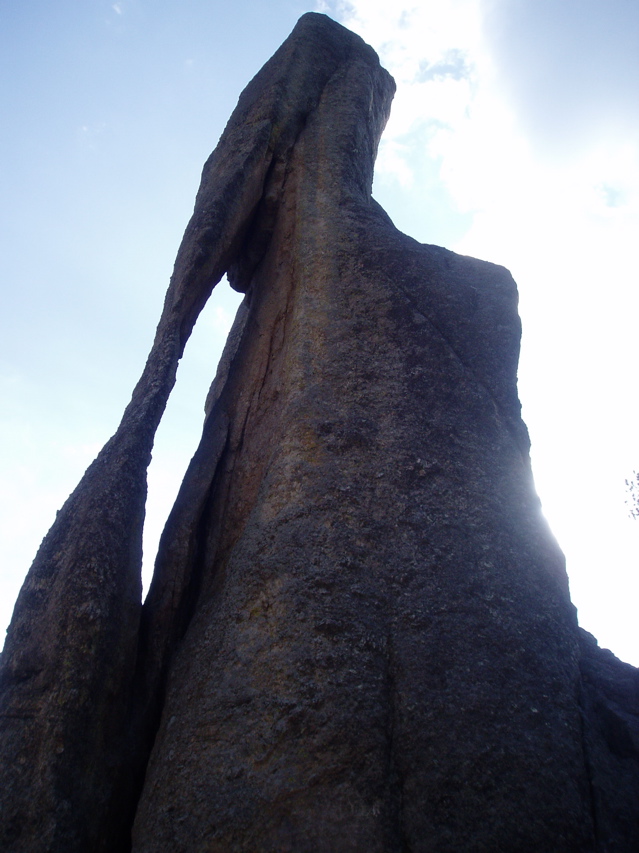 After finally colling off, we started heading back towards Hill City along Needles Highway. This is another twisty road with a few 180° switchbacks and tunnels. There were some very interesting rock formations, including one that looks like the eye of a needle. |
|||
At the end of the highway we split up. I continued to the Crazy Horse monument. This is another mountain carving that’s still in progress. The face of Crazy Horse (a famous Native American that was literally stabbed in the back) is complete but they’ve got a huge amount left to do. The sculptor that started it began work, by himself, around 1948. For 10 years he worked alone, using equipment he was able to scrounge. He built a 900+ step staircase (at a really steep angle) to get up to the work area. He’d carry 100 pounds of equipment and supplies with him whenever he went. He had a used compressor to run the jack hammers, but it had a habit of quitting, so he’d have to put down his load, walk back down the steps, restart it and head back up, pick up his load again and continue up. This happened most days, once 9 times in a day.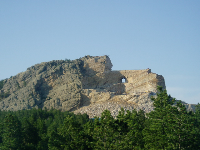 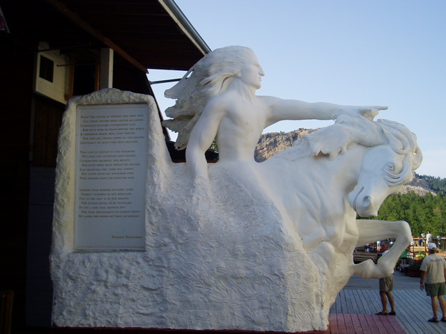 He decided against getting federal funding for the project, believing that the dream of the Native Americans that had commissioned him to do the work would never be fulfilled. The plan was not just the carving, but a complete Native American cultural and education centre. The work has been funded completely by private donations, admissions and souvenir sales. He decided against getting federal funding for the project, believing that the dream of the Native Americans that had commissioned him to do the work would never be fulfilled. The plan was not just the carving, but a complete Native American cultural and education centre. The work has been funded completely by private donations, admissions and souvenir sales. |
|||
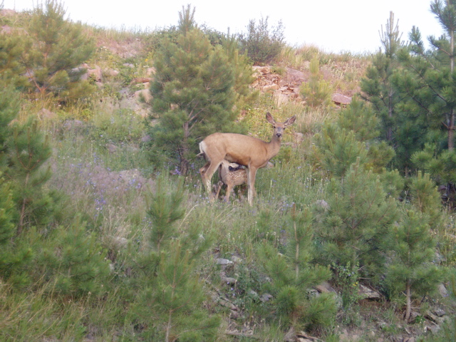 I had dinner at their restaurant, a bison stew Ð quite good actually. After contributing some more dollars with the purchase of souvenirs I decided to go Mount Coolidge, the highest elevation in the area so I could get some pictures from the observation area. I get to the spot and, naturally, there’s a narrow, winding gravel road to the top. So I start. At first it’s not too bad, but my vertigo starts to set in. There are no guardrails along this “road” and I’m getting more hyper as I climb. Approaching the summit I see a doe and two fawns nursing. Nice shot. I had dinner at their restaurant, a bison stew Ð quite good actually. After contributing some more dollars with the purchase of souvenirs I decided to go Mount Coolidge, the highest elevation in the area so I could get some pictures from the observation area. I get to the spot and, naturally, there’s a narrow, winding gravel road to the top. So I start. At first it’s not too bad, but my vertigo starts to set in. There are no guardrails along this “road” and I’m getting more hyper as I climb. Approaching the summit I see a doe and two fawns nursing. Nice shot. |
|||
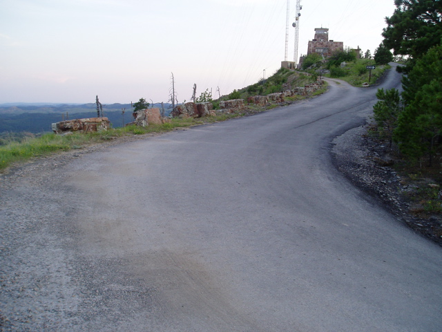
Near the summit I see some pavement and think things will improve. Wrong! There’s a sharp, 180° switchback at the top, on a sloped approach, with the pavement only about 10 feet wide, and virtually nothing to stop a motorcycle from flying over the crest of the hill. (If you were in a car, the concrete blocks would probably not let you go through, but there were 2-3 foot gaps between these blocks.Suddenly my head was spinning and my mouth felt like cotton. I was shaking so much I thought for sure I’d drop the bike. Somehow I managed to back down the hill a bit until I could find a place to put the kickstand down. I crawled off the bike and sat down for a bit until my head cleared. I got some pictures, but not from the top. I just couldn’t do it.
   |
|||
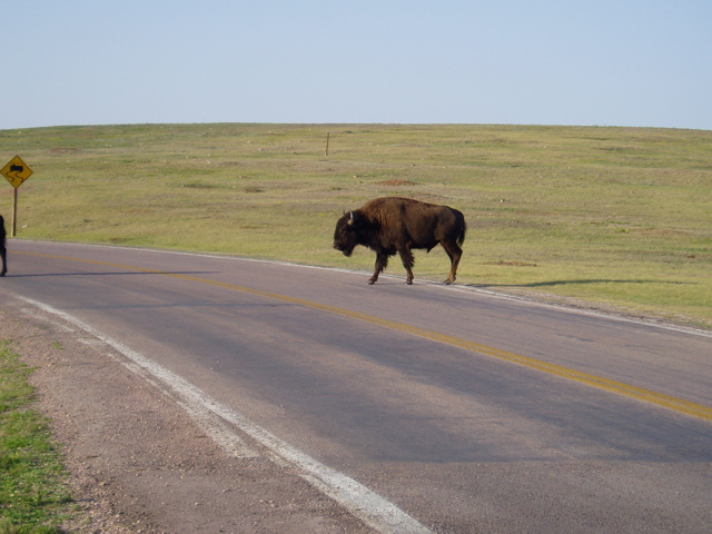
| After finally calming down, I returned back to the main highway and decided to go to Mount Rushmore for the night show. The GPS suggested the Needles Highway, but it was twilight and I didn’t want to risk that particular road at that time. The next suggestion was Iron Mountain, a little better, but not much. I started riding towards that road. Just before the turnoff I saw a bison on the right side of the road, just walking along slowly. A van in front of me pulled over so they could get a better look. I passed and continued along. Just after I turned onto Iron Mountain Road I noticed another bison on the left, traveling in the same direction as me. I didn’t think much of it and started accelerating. Just then, the bison decided to run, flat out, diagonally across the road in an attempt to cut me off. I rolled on the throttle (and damn near soiled myself). When I went past him, there was only about 2 feet between me and this charging 2000-pound animal. I’ve had dogs go after me on a bike, but nothing that big. | |||
| After my heart returned to normal beating I continued on. Twilight. Mountain road. Lots of animals. You guessed it. I must have had 6 or 7 deer run across the road in front of me. Going around one corner I saw another bison. I thought for sure these could smell the bison on my breath from my dinner, and wanted revenge. Thankfully this one was set back from the road and I was able to get past easily. | |||
| When I finally got to Mount Rushmore, there were only a few minutes left of the show so I watched from the parking area. As I left, another deer bounced across the road. Time to head back to the hotel. | |||
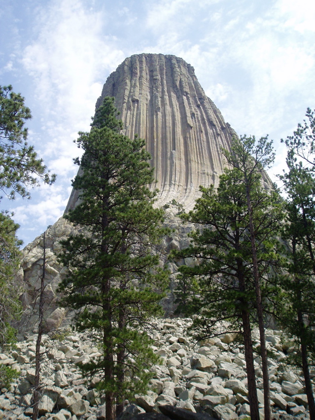
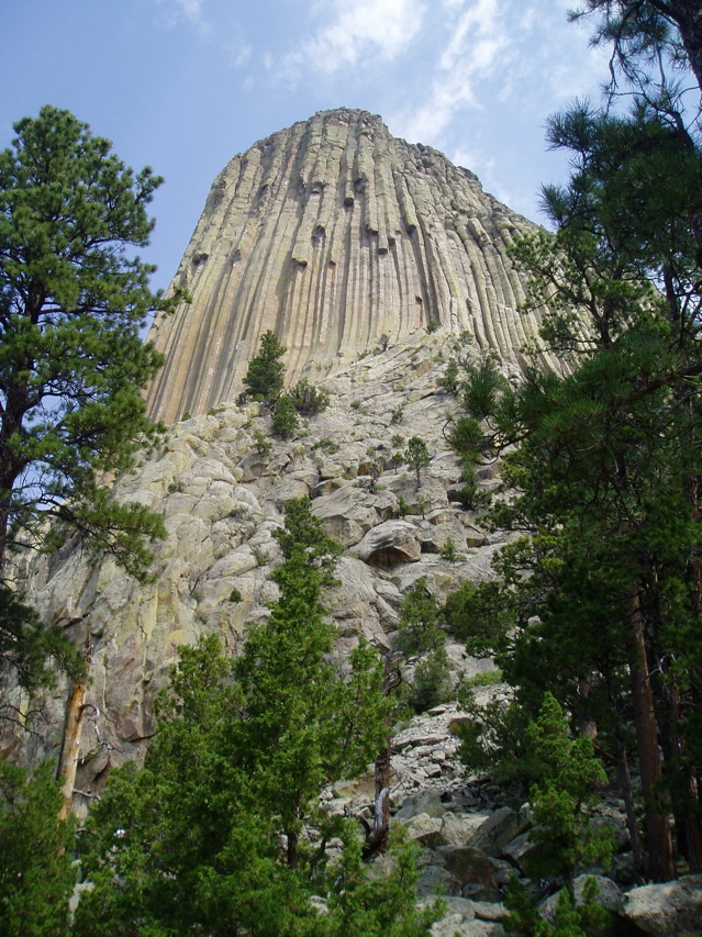
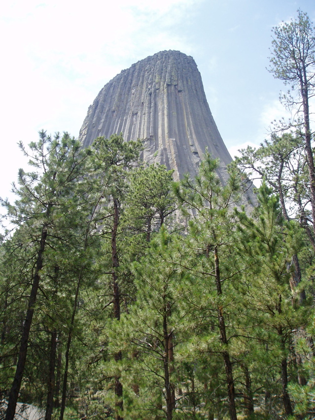
Friday, June 30 I decided to go to Devils Tower in Wyoming. The roads were nice, sweepers most of the way. The Tower itself is huge, sticking straight up out of the surrounding plains. At the visitor centre I parked the bike, converted the tank bag into a backpack and went on the 1.5 mile hike around the base (yes, in long pants and riding boots). It’s amazing the size of the rocks and columns that have fallen off the Tower, though nothing in recent history.
    |
|||
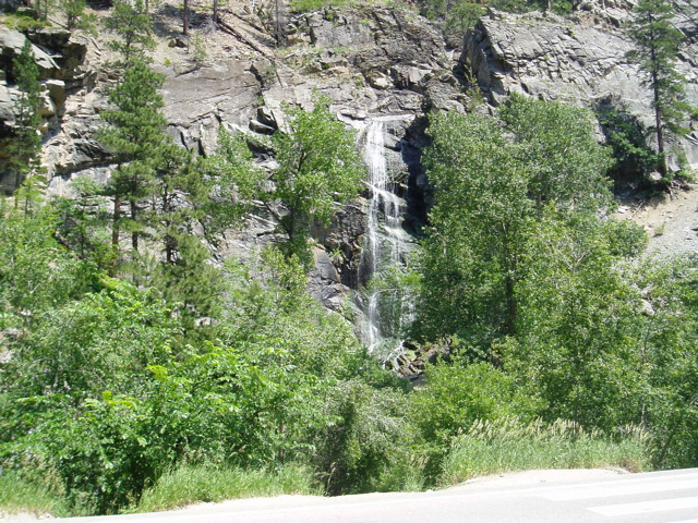
I then rode back towards Lead and Deadwood, then went though the Spearfish Canyon. Impressive road (except for a little bit of construction with loose gravel) and lots of nice scenery.
   |
|||
| I got back to the hotel for a quick freshening before the closing banquet at Sylvan Lake Resort. I used the upper part of Needles Highway there and back – 4 180° switchbacks each way. It was one of the two routes they suggested, and the more technical of the two.I got everything ready for the ride back home. I had brought an extra sack for the bike, just in case, and I needed it for the things I had bought the family. | |||
Highway 11/Yonge St. – Rainy River to Toronto |
|||
| Saturday, July 1 I packed the bike, checked out and was on the road at 7am local time. The skies were threatening, but once on I-90 past Rapid City they cleared up. This was slab day: 340 miles from Rapid City to Sioux Falls, then another 300 to past Fargo. I stopped at Drayton, ND, “catfish capital of the north” for the night. | |||
| Sunday, July 2 I got on the road again by 7am local time, heading towards Baudette, MN. I got there about 10:30am and crossed into Canada at Rainy River, ON. | |||
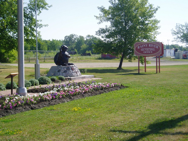  I took some pictures, including a “Yonge St.” sign, then headed east towards Thunder Bay. Some of the roads were a little rough, and some were boring, but it felt great to be back in Canada. The temperature was a little cooler as well, so riding was more comfortable. |
|||
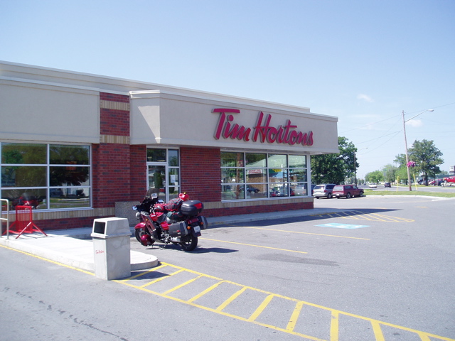 My first taste of a return to civilization came in Fort Frances – Timmy’s! I seriously needed a coffee and some food. The coffee was great, but the chili combo stayed with me for most of the day. My first taste of a return to civilization came in Fort Frances – Timmy’s! I seriously needed a coffee and some food. The coffee was great, but the chili combo stayed with me for most of the day. |
|||
 Just past Thunder Bay I stopped for a few minutes at the Terry Fox Memorial. He had to bail just west of there because the cancer came back. Just past Thunder Bay I stopped for a few minutes at the Terry Fox Memorial. He had to bail just west of there because the cancer came back.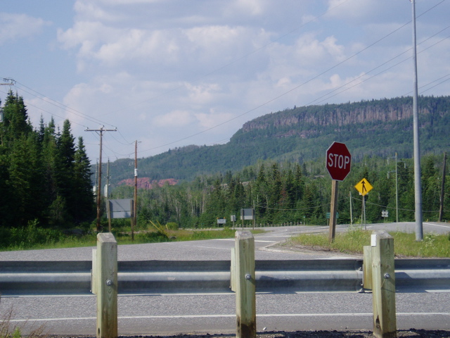 At Nipigon I continued north on Hwy. 11 towards points north. Several stretches of the road hug shorelines. Some of the rock formations rivaled what I had seen in the US. At Nipigon I continued north on Hwy. 11 towards points north. Several stretches of the road hug shorelines. Some of the rock formations rivaled what I had seen in the US. |
|||
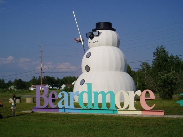 Beardmore was the first town, with an interesting welcome. I got as far as Geraldton and decided to grab a motel for the night. Beardmore was the first town, with an interesting welcome. I got as far as Geraldton and decided to grab a motel for the night. |
|||
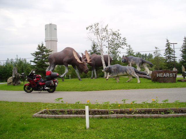
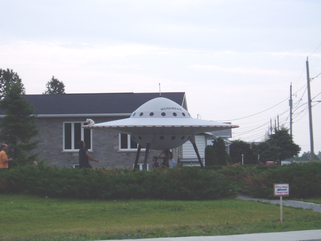
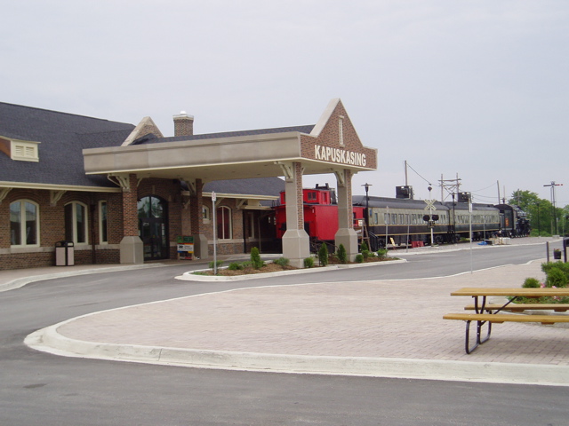
Monday, July 3 In retrospect I think I should have continued on to Hearst, another 2.5 hours away. Hearst is a much bigger town (6000 vs 2600) and there’s a much better choice for accommodations. I forgot the sun would set a little later that far north and west, so I wouldn’t have been riding in “moose country” in the dark. I took some more photos of the welcomes in Heart, Moonbeam and Kapuskasing (the home of GM’s “cold weather testing facility”)
   |
|||
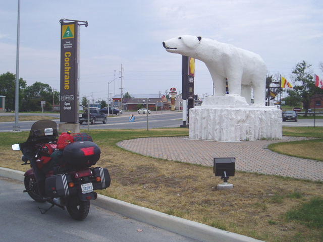  I made it to Cochrane, at which point Hwy. 11 “east” becomes “south” as I finally start heading towards Toronto. I made it to Cochrane, at which point Hwy. 11 “east” becomes “south” as I finally start heading towards Toronto. |
|||
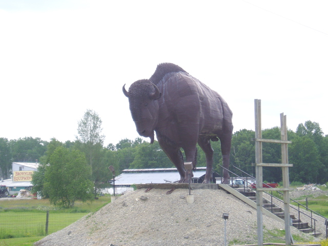 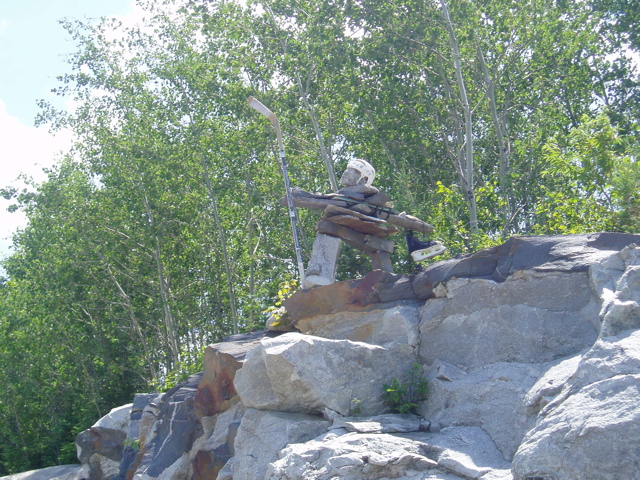 In Earlton there was a buffalo statue, which sure looked to be as big as the one that tried to take me out on Iron Mountain Road.Typical inukshuk markers were everywhere on the trip, at least in Canada. I did see one that was rather unique, though. In Earlton there was a buffalo statue, which sure looked to be as big as the one that tried to take me out on Iron Mountain Road.Typical inukshuk markers were everywhere on the trip, at least in Canada. I did see one that was rather unique, though. |
|||
| I continued on through Temagami and into North Bay where I grabbed some dinner (first food that day). More slab as I head towards Huntsville, Orillia and Barrie. I’m in the home stretch now, so realizing my goal is close at hand, my spirits (and speed) were rising. Hitting traffic between Orillia and Barrie solved the speed issue.At Barrie I got off the 400/11 so I could follow “Yonge St” from Barrie to Bradford, where it’s known as Barrie St. until Hwy. 11 intersects again. I then followed Yonge all the way to Queen’s Quay in Toronto where I took some pictures around 10:45pm. | |||
 While taking the shots a fellow walking his dog asked if I had just finished the ride from Rainy River. I guess I was that obvious. After chatting a few minutes I left and hopped on the DVP and 401 to get back home. Getting into Pickering I saw a lot of lightning north and east. I got home without any rain (though I found out later there was some severe weather at the time from Oshawa to Peterborough). While taking the shots a fellow walking his dog asked if I had just finished the ride from Rainy River. I guess I was that obvious. After chatting a few minutes I left and hopped on the DVP and 401 to get back home. Getting into Pickering I saw a lot of lightning north and east. I got home without any rain (though I found out later there was some severe weather at the time from Oshawa to Peterborough). |
|||
Summary |
|||
| I started the ride at 9:30am on Saturday, June 24, with the odometer reading 57,972 km. I ended the ride at 11:30pm on Monday, July 3, with the odomoeter reading 67,265 km. Over the course of 10 days I had ridden 9,293 kilometers. Adjusting for error in the odometer based on the GPS report of the BBG, actual distance was probably about 9,098 kilometers, but the GPS was turned off for some of the riding I had done (the ERC and some short rides around Hill City). All the riding was done alone with the exception of about 500 kilometers when I was riding with fellow COGgers.I was able to complete a Bun Burner Gold, after 2 failed attempts.I traveled some great roads.I met some new friends from across the continent.
I did the Rainy River – Toronto ride. All of this with virtually ideal weather for most of the trip and no major mishaps. Definitely a success and worth the time. |
|||
| Return to Summary |